The Webster District
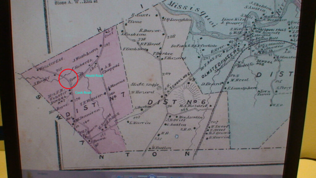
On the farthest western extremity of Sheldon, District No 7 was also know as The Webster District. On some occasions District No 6 may also be included in the “West End” The red circle on the map shows the intersection of what is now the Cook Road with the Heald Road. Within that circle lies the Webster Cemetery. A short distance away is the Webster School with Mrs. Webster as the teacher. Even today the open expanse of land from the borders with Swanton and Highgate encompass hundreds of acres of farm land. The original Sheldon Poor Farm stood just south of the school on the now Cook Road.