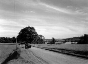
 Rice Hill describes a geological formation located near the intersection of Vermont Route 78 and Shawville Road. The Rice Hill Road proceeds in a northerly direction up an incline known as Rice Hill. Although not an officially designated hamlet Rice Hill posses two “Rice Hill” land marks. In this older photo you can see the old road.
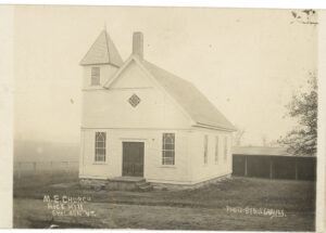 Rice Hill Church shown in this older photo continues to hold worship services.
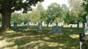 The Rice Hill Cemetery sits opposite the church.
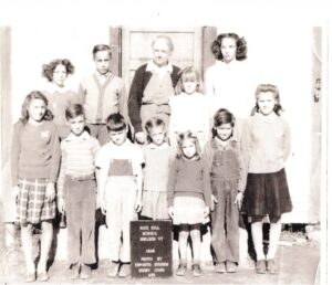 Rice Hill School spoke to the population of the area that required a separate school. This 1948 photo of Mary Whitings class attest to its existence.
However the designated name of the location on Vermont Route 78 is “Shawville”. Both the Vermont State Map and the Sheldon Maps all designate a section of Route 78 as “Shawville”. There in lies the question “Why Shawville”?
The records for the “Rice Hill Cemetery” designate over 30 graves as the final resting place of individuals bear the surname of “Rice” as would be expected. However Shaw appears on only 3 grave sites. Abraham Shaw 1851 to 1911 is buried along site his wife Mary E Doolin Shaw 1850 t0 1925. A infant son son James 1874 rests in a separate grave. Is it possible that this man born in nearby Highgate who moved to Sheldon to raise a family has a hamlet named for him? Another possibility consistent with historical occurrences is that the original occupants of the area came from nearby “Shawville. Quebec Canada and named the area after their former home.