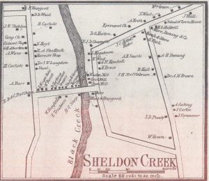
 On This Map from 1857 you can see Bridge Street as it goes East from Main Street and intersects with what is now Church St and the former Depot Street.
At the location of our current Historical Society Building the Weed and Hapgood Store is noted. Additional structures opposite, north of the building, and along with east side of Black Creek include the Woolen Mill, the Grist Mill and a Saw Mill.
The significance of our current location encompasses its significance in regards to the industrial and commercial development of Sheldon through the late 1700s and into the 1900s
Keith Brothers Foundry
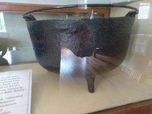 The Sheldon’s completed their land transaction in 1791 and renamed the town Sheldon from its previous Hungerford designation. However, in 1790 a foundry was built by the Keith brothers on the east side of the creek.
This kettle is among our artifacts to be seen at the museum,
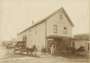
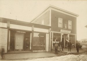
This photo is of the WC Marsh store that replaced the Weed and Hapgood store after it burned in 1884. The time line is after 1897 when the building to the right was constructed by Mr. Marsh to accommodate the Post Office. The railroad built in 1876 would be to the left of this structure.
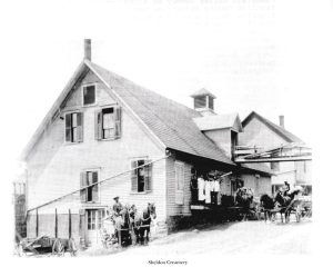 In the rear is the Alden Brother’s Creamery. Note the horizontal line running to the right which actually joins the railroad siding to the creamery building.
In this photo note wagons and horses.
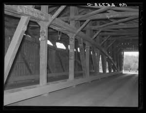
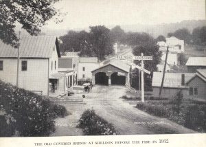
 This two lane covered bridge was built in 1836 and stood at that location until April 1932 when it and most of the surrounding buildings burned.
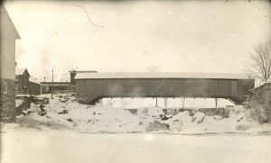
This winter photo shows the bridge along with the mentioned Post Office Square to the left and the mill on the far left.
The area, known as Post Office Square, encompassed the social, industrial, and commercial hub for the village. In addition to what is obvious there was also a dance/meeting hall over the store along with a barber shop and tin smith shop. In addition a closer look at the post office window reveals the presence of the library which was housed there at the time. Note the wooden walkway and the wooden structures that provided the pathway for the bridge fire in 1932.
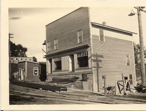 Mr. Mower rebuilt the store at our current location in 1932. He was the only merchant to reconstruct. It was used continually as a “Country Store” through the 1950s.
The Sheldon Town Clerk occupied the lower level on the right or west side of the building as the Town Office until a new building was erected in 1952.
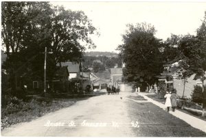 Looking east from Main Street one clearly sees the industrial complex that existed and surrounded the current society location.
 This photo shot from east to west shows the railroad tracks so it is after 1876 along with the store, the post office, the railroad, and the building opposite the store which was likely the black smith shop.
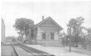 The railroad station built after 1876 occupies a location west of the railbed. This view, looking south toward the curve leading to Fairfield shows a second rail to the right along with structures to the south which were likely part of the brick kiln. It was torn down in 1980.
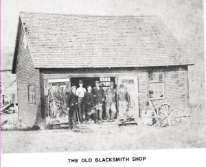 This Blacksmith Shop, photo taken around 1906, located to the right of the bridge and close to the store burned in the fire of April 1932.
Structures lost in the fire of 1932 included Alden Brother Creamery, the Managers House, the WC Marsh General Store, the Masonic Hall on the second floor, the Post Office, the Harness Shop on ground level, The Barber Shop, the H.H. Mower Hardware Store, Northrup Grist Mill and storage buildings, the covered bridge, the Saw Mill, the Wheelwright Shop, the office of Edgar Holmes owner of the Wheelwright Shop and the Saw Mill, and a shoe repair shop. The significance of the impact of the fire can not be over emphasized.